


They face a fight that could reshape neighborhood streets and pocketbooks as a new property law gives the city broader authority over road repairs and development. This dispute could force homeowners to shoulder costs or accept changes that make local roads worse — and knowing how the law works lets them push back effectively.
Coverage will unpack how the conflict started, what the law actually allows the city to do, and practical steps homeowners can take to protect property lines and public infrastructure. Expect clear examples of the legal claims at stake and what tactics have worked so far in similar battles.


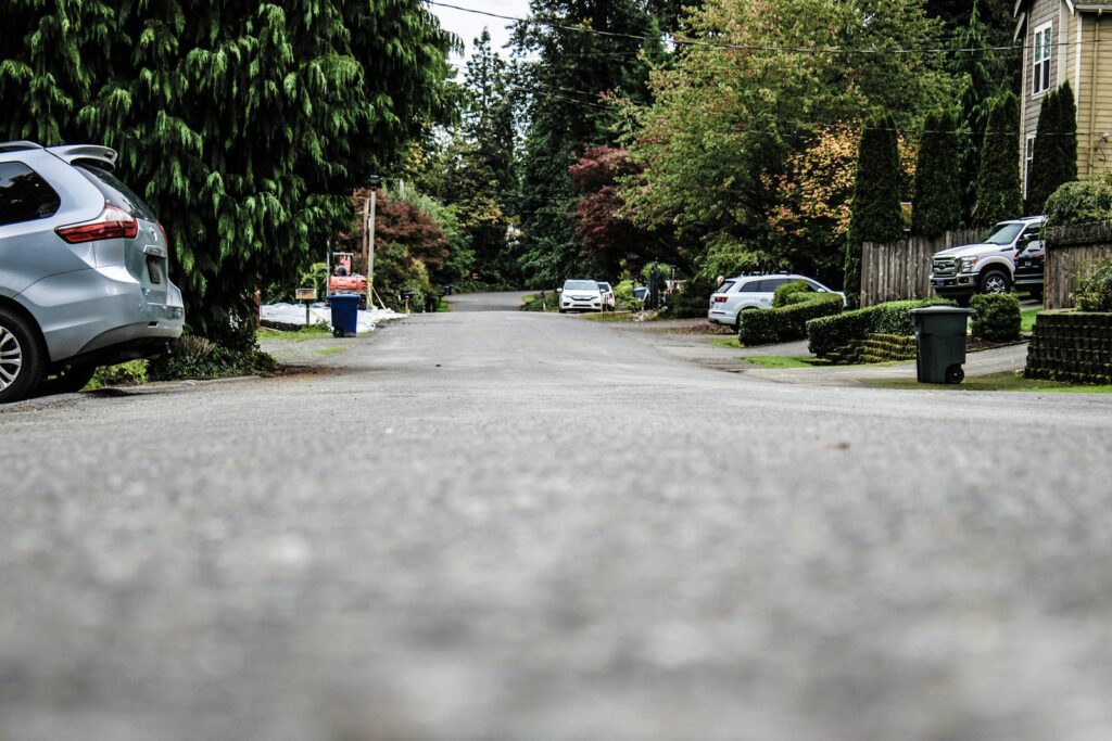
Understanding the Homeowners’ Battle With the City
Homeowners say city-installed markers shifted property lines, sparked boundary disputes, and raised questions about zoning enforcement. They claim encroachments into private yards and potential long-term impacts on neighborhood infrastructure.
Background of the Dispute
Residents on Copperfield Drive and nearby streets reported finding metal stakes and markers placed by city crews inside their fenced backyards. Homeowners contend those markers moved established property boundaries and conflicted with recorded deeds and survey plats. Several homeowners hired land surveyors who documented discrepancies between the new markers and existing property lines.
The disagreement escalated when some homeowners learned the markers supported a city plan for stormwater work and right-of-way adjustments. Neighbors formed a group to share survey results, legal advice, and costs for title research. The dispute now mixes technical boundary issues with distrust over municipal communication.
Key Issues Raised by Property Owners
Homeowners focus on property rights and whether the city followed legal procedures for changing easements or public right-of-way lines. They argue the city failed to publish notice, obtain easement deeds, or secure written consent from affected owners. Many cite concerns about encroachment where public infrastructure work appears to occupy private land without compensation.
They also raise zoning ordinance questions: whether any reclassification or site plan review occurred and if the city complied with public-notice rules. Homeowners worry that uncorrected marker placements could cloud titles, affect resale, and trigger costly boundary litigation to restore original property boundaries.
Potential Risks to Local Roads
Property owners and engineers warn that shifting apparent right-of-way lines can alter where the city places culverts, drainage ditches, and curb work. If the city narrows the official roadway or claims private frontage for stormwater facilities, that could concentrate runoff and stress pavement sections not designed for the new drainage patterns. Those changes risk premature road cracking, erosion at shoulder areas, and added maintenance costs.
Adjacent property changes may also force the city to reroute utility access or widen shoulders into private land, creating more encroachment disputes. Homeowners fear repeated small encroachments could cumulatively require expensive road reconstruction or legal settlements that divert local maintenance budgets.
Local Government’s Position
City officials say crews placed markers as preliminary survey references tied to an approved stormwater and right-of-way project. They assert the markers do not alter legal property lines and that any formal boundary change would require recorded easements or council action. The municipality emphasizes standard practice: preliminary stakes guide engineering, later replaced by formal plats if the city acquires land.
Officials also point to compliance with internal procedures and say they will coordinate with affected homeowners before finalizing construction plans. They maintain the project aims to improve drainage and protect roads from flooding, arguing the long-term benefit outweighs temporary concern over marker placement. For more on similar municipal disputes and homeowner pushback, read reporting on a nearby property line battle with city crews.
Navigating Property Laws and Protecting Homeowner Rights
Homeowners should know where their legal boundaries lie, how to challenge encroachments, which documents control title and easements, and who to call for help. Clear records and timely action prevent small disputes from becoming costly court cases.
How Property Lines and Boundaries Are Defined
Property lines come from the legal description in the deed and the measurements shown on a plat map or property survey. The deed may reference metes and bounds, lot-and-block, or a recorded plat; those words determine how a land surveyor sets corners and monuments on the ground.
Recorded easements, right-of-way instruments, and municipal street dedications can alter usable boundary lines even when the deed doesn’t change.
If neighbors disagree, most courts rely on the survey and the deed’s legal description first, then on historical use (prescription) or boundary agreements. A recent, stamped land survey that ties into recorded plats carries more weight than an informal sketch.
What to Do About Encroachments and Easements
When a structure, fence, or driveway crosses a boundary, document it immediately: photos, dates, and a written account. They should compare the current property survey with what’s on the ground and the deed’s easement language to see if the use is permitted.
For minor, fixable encroachments, negotiating a boundary agreement or a written easement with the neighbor often resolves the issue faster and cheaper than litigation.
If negotiations fail, the homeowner may seek a court order for removal, damages, or a declaratory judgment. They should consider adverse possession rules, which require continuous, open, and hostile use for a statutory period; adverse claims need prompt legal response. For examples of common property law issues and remedies, homeowners can consult resources that explain typical dispute paths and outcomes (https://www.thecoffeemom.net/common-property-law-issues-homeowners-face/).
The Role of Deeds, Surveys, and Plat Maps
A property deed establishes legal ownership and contains the exact legal description courts use to identify boundary lines. Deeds may also reference recorded easements or covenants that limit use. They should always check chain-of-title transfers for hidden interests.
A certified property survey by a licensed land surveyor re-creates those legal descriptions on the ground; it shows corners, structures, encroachments, and easement locations. A surveyor’s stamp and ties to recorded monuments make the document admissible in court.
Plat maps filed at the county recorder’s office show lot dimensions and streets for subdivisions. When discrepancies appear between deed language and a plat, courts often reconcile them by looking at primary recorded documents and physical evidence. Maintaining copies of deeds, the latest land survey, and the plat map simplifies dispute resolution and protects the homeowner’s position.
Legal Resources: Attorneys, Surveyors, and Dispute Resolution
Homeowners should hire a licensed land surveyor for precise boundary determinations and a real estate attorney for interpreting deeds, easements, and filing court actions. Surveyors produce the technical evidence; attorneys translate that evidence into legal claims or defenses.
Alternative dispute resolution, like mediation, often resolves boundary and easement conflicts faster. When matters involve public roads or municipal actions that could affect neighborhood infrastructure, a real estate attorney can request injunctions or represent the homeowner in hearings.
Practical steps: obtain a current property survey, gather deeds and plat maps, document encroachments, and consult a property lawyer before signing agreements. If cost is a concern, some counties offer recorded document searches and fee schedules that help homeowners find relevant records without unnecessary expense (https://www.findlaw.com/realestate/land-use-laws/what-are-my-rights-as-a-homeowner.html).
More from Decluttering Mom: